Mapping agricultural areas and extracting spectral characteristics of crop fields isa well-known remote sensing task. Information form satellite scenes canimproves the management of agricultural resources and this is due to the temporal and geospatial frequency of these images.
The MAP.ING team offers services related to digital agriculture, helping to close the loop called precision agriculture. The foundation of precision agriculture is to process data from satellites in such a way that they are reliable geodata inputs for agricultural technology.
Basics of Precision Agriculture
1. Satellite Imagery
2. Image Processing
3. Input field data
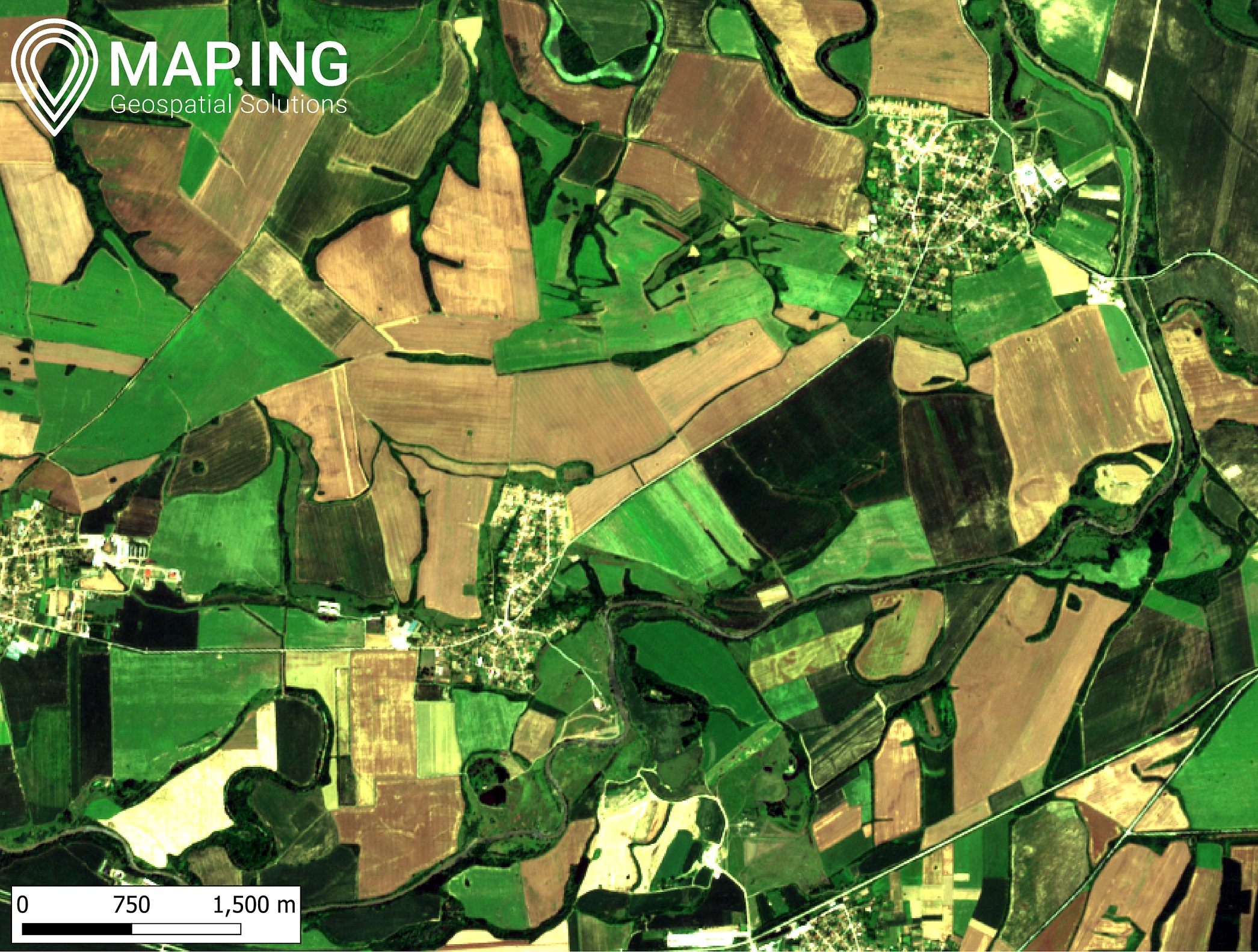
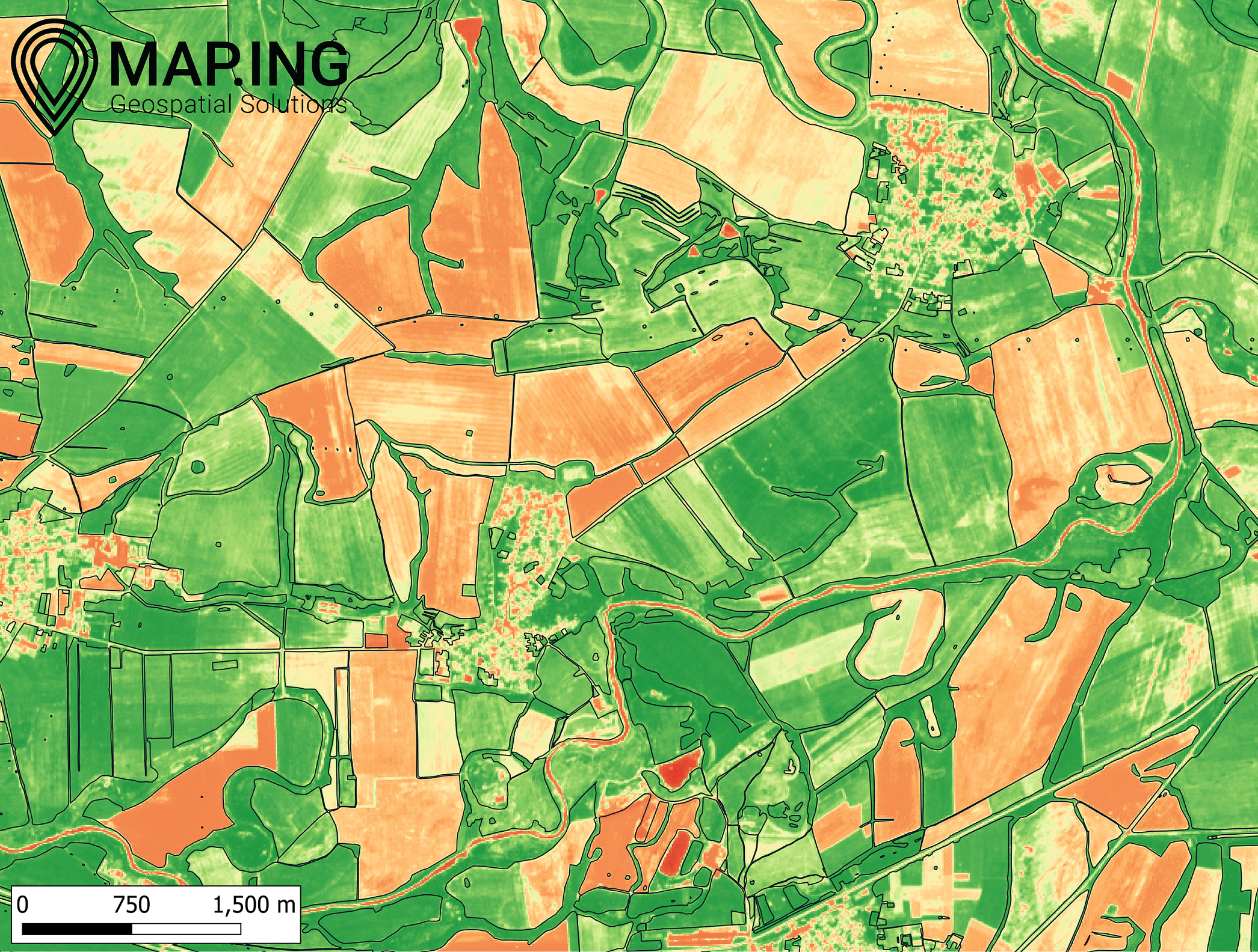
Vegetation indices reflect the condition of agricultural crops. These indices may be different for different types of crops. The most used vegetation index is the normalised vegetation index, the so-called NDVI. For its calculation, the amount of reflected energy is the red and infrared spectrum. See the level of detail in the mapping of agricultural areas in the region Veliko Tarnovo using NDVI and the deils that are not visible to the human eye:
Fig. 1 Left: vegetation index, right: orthophoto mosaic. The captured territory is in the region of Veliko Tarnovo (Bulgaria). Vector data is taken from the Ministry of Agriculture and Foods (2020)
Contact us!
Interested in consultation, sooperation or proce offers write us an email: info@map-ing.com or call us: +359 877 846 278